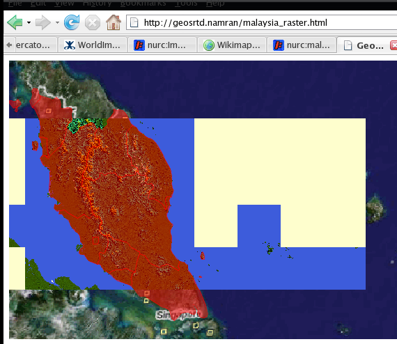
today manage to get input correct for geoserver..
from SRTM file.. export to GeoTiff format.. and geoserver won’t compain much before
successfully response to client request..
but for world image.. geoserver need :
1. a worldimage file itself something like png.. jpg..
2. a world known text (WKT) containing a georeferencing information. .. in *.tfw format
3. a prj file containing the SRS definition.. normally in *.prj format
the result is something like this :
and… this :)
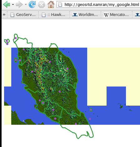
….
enough of this.. also manage to learn how to do this .. :) .. 
thanks to Sarah..
this is where the imagination can be really put into a result… hahahaha..